Part Ten of Into the West is the continuation of a multi-part series that chronicles the journey that Shelley and I embarked on in late August and early September of last year. A journey that covered over 5,000 miles, seven states, and two provinces of Canada over the course of about two weeks. If you missed any of the previous parts click here to get caught up.
Day Twelve
The morning of day twelve we awoke in the Fox Hotel near the heart of Banff, Canada. Shelley and I planned to travel back north into Banff National Park, with the hopes of seeing Moraine Lake, Lake Louise, and a leisurely drive down the Bow Pass Parkway back to Banff. Banff National Park was Canada’s first National Park and it was founded in 1885. One of the things that still stands out in my memory is that the rest areas, at least in this part of Canada, offer the most stellar views of the scenery. I guess that I’m just used to the flat lands of the Midwest plains states of the U.S., where the rest areas are normally evenly spaced to provide drivers with a break.

The drive from Banff to the village of Lake Louise was relativity short. One thing to keep in mind if taking a trip to Banff National Park in Canada is that Canada using the metric system, so all road signs–mileage or otherwise, are in kilometers and not miles. The village of Lake Louise is the gateway to hiking, camping, and various other outdoor activities. If you are planning to stay in Banff and then visit the village of Lake Louise, make sure that you get an early start because the parking areas can and will fill up by midmorning.
Moraine Lake
Moraine Lake was Shelley and I’s first stop of the day. The short drive from the village of Lake Louise is on a curvy two lane road that has narrow shoulders. However the road does provide pullouts at the scenic areas.

After stopping to both enjoy and photograph the view, we continued on to Moraine Lake. Upon arriving at the parking area at Moraine Lake we were afraid that we would not be able to find a parking spot. The parking area is a one-way and the spaces are marked for the different types of vehicles. There are spots for the tour buses and RV’s, of which there were plenty. Luckily we were able to find a space after heading down the exit lane.
After parking the vehicle, Shelley and I loaded up and made the hike to Moraine Lake. Moraine Lake is a glacier lake which is nestled at the base of the mountains on it shores.

The lake shore is rocky, the water is a beautiful blueish-green, and even if the wind is light it is cool. Shelley and I decided that this would be a great place to make another photograph featuring two of our most favorite people.

By the time that we had finished photographing the lake it was close to lunch time. Luckily there is a lodge at Moraine Lake that has a gift shop with a cafe in the lower half of the lodge.

While eating lunch, I spotted a new little friend.

After finishing lunch we made our way back to the vehicle and then headed back down the road to Lake Louise.
Lake Louise
By the time that we reached the parking area for Lake Louise it was full. This meant that we had to circle the lot for between 10 to 20 minutes to find a spot. After parking we loaded up and headed to the shore side of Lake Louise.

Over the course of human history in the Canadian Rockies, Lake Louise has had at least three different names. The first was given to the lake of the Native American Stoney Tribe–Lake of the Little Fishes. The second name that was given to the lake was Emerald Lake, which was given by the first European visitor to the lake in 1882. The name was changed again in 1884 to the current name, which was given to the lake by Queen Victoria, who named the lake after her fourth daughter.

Bow Valley Parkway
The Bow Valley Parkway runs south from the village of Lake Louise to Banff. It is a slower route to take than the Highway 1 Expressway; the speed limit is about 30 MPH. This is due to the fact that animal crossings of this roadway are more common. The
Bow Valley Parkway is not fenced off like the expressway, which allows for elk, wolf, dear, mule dear, and big horn sheep to cross the roadway throughout the year. The Bow Valley Parkway is called Highway 1A on some maps.

You could easily spend two to three full days hiking and exploring The Bow Valley Parkway area of Banff National Park. On this trip we only had one full day to cover as many things as possible in and around Banff, which meant that we had to chose the things that we wanted to see, while utilizing our time there to the max.
CASTLE CAMP
Castle Camp was the location of an internment camp starting July 14th, 1915 for German and Austrian immigrates during World War I. Canada entered into the “war to end all wars” in August of 1914 and within the first year, started interment of alien enemies. These were generally persons from Germany, the Austria-Hungary Empire, and Bulgaria who failed to register and report to the local civil registration center. Civil registration centers were located in every Canadian city.

STORM MOUNTAIN
Storm Mountain is not the tallest mountain in the Canadian Rockies, but it does reach a height of 10,310 feet.

CASTLE CLIFFS
Castle Mountain shows up on maps of the area starting in the late 1850’s.

After stopping to photograph Castle Cliffs we noticed that traffic was slowing and stopping along the side of the road a short distance ahead. This is where we saw our second black bear of the trip. Shelley was able to grab a few photographs of the bear from the car–he or she was to close too the road for either of us to safely exit the vehicle for a better angle.

MOOSE MEADOWS AND THE SAWBACK RANGE
Moose Meadows provides the perfect viewing area of the Sawback Range in Banff. Although the range can be seen from Highway 1, this pullout along the Bow Valley Parkway is perfect.

ANCIENT ASPEN PICNIC AREA

Ancient Aspen Picnic Area, Banff National Park Canada
BACKSWAMP
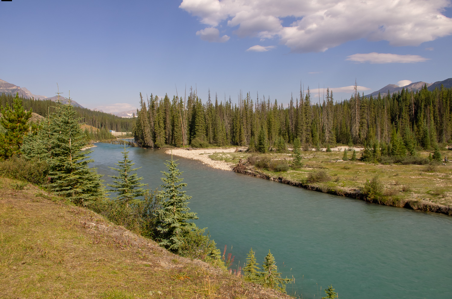
The Backswamp was created over time by the deposition of gravel and sand from Brewster Creek where it flows into the Bow River. From this stop on the Bow Valley Parkway you can see the Mount Bourgeau, which rise to 9,651 feet. You can also see Mount Howard Douglas, which reaches a height of 9,350 feet.

In the summer time you are likely to see Osprey and Great Blue Heron, while Ravens can be found all year round.
VERMILLION LAKES AND THE BEAR
Before Shelley and I returned to Banff for the evening we went for a closer look at the Vermillion Lakes. As we were driving the dead end road to the lake, we were greeted by yet another black bear walking along the side of the road.

Black Bear at Vermillion Lakes, Banff National Park Canada
We continued down to the turn-a-round at the end of the road, where I made the photograph below before changing the lens on my camera to one that is better suited for photographing wildlife.

By the time that we returned to where the black bear had been it was gone. However, I was able to make this cool image of a heron.

And then it was back into town.

Downtown Banff
After unloading the vehicle from the day’s journey, we decided to walk into downtown for dinner, and also to do a bit of shopping.


Shelley and I ended up settling on eating in an Irish Pub–which was delicious, by the way.


