In late August and early September, Shelley and I set out on a Great American road trip. We left our home base in Parkville, Missouri and headed west. The plan was a scouting trip for future trips. We stayed with friends along the way and also made some new ones. Photography trips are more about the journey for me then the final destination. Shelley and I could not narrow down what places we wanted to see on the trip. In fact, the list of National Parks and attractions seems to have grown far beyond what we both thought that we could see in the limited two-week time period. When we were first planning the trip we both decided that Yellowstone and Glacier should be included. At one point the threat of wild fires made us even think about changing our plans. During this point in the planning process we strongly debated going to the Virgin Islands instead. Luckily the threat of fires moved away from our target locations and we proceeded in our planning. We finally settled on the following shooting schedule: Grand Teton National Park, Yellowstone National Park, Glacier National Park, Banff National Park in Canada, Devil’s Tower National Monument, and time permitting, Badlands National Park. I know what you’re thinking, all of that in about two weeks? Yeah right… Keep in mind that I earlier said that this was a scouting trip. This means that we knew that we would not be able to see everything in every place. But in some of the places we surprised ourselves with how much ground we were able to cover in the limited amount of time.
The First Half Day
We left Parkville, Missouri around 2:00 PM in the afternoon and headed out for the afternoon and evening on the road. By the end of the day we stopped in the town of Kearney, Nebraska. The drive that day took us north along I-29 from near it’s starting point in Kansas City, Missouri, north of the Missouri River, to a few miles north of the Iowa-Missouri boarder. At that point we turned to the west, taking Iowa State Highway 2 which connects with Nebraska Highway 2 to Lincoln, Nebraska where we picked up I-80 heading west. Along the way we saw the damage that the drought of 2012 had caused. In some areas of Nebraska the corn crop was green and alive. In some places you could drive a few miles and the damage was more dead or dying crops. There were places where the land was burned. Sometimes these areas were close to the road and others there were tracks of land that had been blackened for as far as the eye can see.
Day Two
We woke in Kearney, Nebraska to a wonderful sunrise and headed west on I-80 toward the high plains and beyond to the mountains. The lands were dry and every few miles you could see more of the damage that the drought had brought. We drove until the first welcome center in the state of Wyoming, which provided us with more information about the surrounding states. I was surprised to find that they had state maps for every state that borders Wyoming and information about different sites and attractions in the surrounding states. After having a delightful conversation with the lady who was working at the welcome center, we continued on our way, heading west along I-80 toward Cheyenne.
Cheyenne
Shelley had been in Cheyenne a couple of times before our trip. As we approached Cheyenne she suggested that we stop to see the Wyoming State House in Cheyenne. I love photographing state houses, and so far I have not found any two to be identical; although some of them invoke the feeling of likeness from a distance. The Wyoming state house, while not as large as the state houses of Minnesota, Missouri, and Arkansas, still shines. There is a strength in the grey sandstone of the building that came from quarries near Fort Rawlins, Wyoming. Other sandstones were used from quarries near Fort Collins, Colorado. The dome of the State House which was originally made of copper, was covered with gold leaf starting in 1900 after it began to tarnish. Gold leaf has been applied five times to the dome the last time was in 2010.

Vedauwoo’s
After walking around the State House grounds in Cheyenne we returned to I-80 and continued our journey west. Prior to starting our trip a friend of mine had suggested that we stop for a stretch at Vedauwoo (pronounced: vi də vu:), part of the Medicine Bow National Forest. This suggestion was by far one of the best last-minute additions to any trip. This rocky outcropping can be seen from I-80. It is located to the north of the Interstate and can be accessed from exit number 329. There is a $5.00 day-use fee for the area. The area was used as a military testing ground until 1961. The out-cropping is caused from the forces of erosion after the uplift of the Laramie Mountains, which began some 70 million years ago. The Vedauwoo area is home to a wide variety of wildlife including and not limited to elk, mule dear, prairie dogs, moose, pronghorn antelope, mountain loin, beaver, least chipmunk, and turkey. Vedauwoo is the Anglicized word from the Arapaho word bito’owu, which means of earth-born.

The Ames Monument
On the south side of I-80 at exit 329 lies a monument to the Ames brothers. The monument site is located near the site of the ghost town of Sherman. The town sat along the first transcontinental railroad in the 1860’s. Sherman became a ghost town in 1918 when the Union Pacific Railroad relocated the rails three miles to the south and closed their yard. The monument is visible mainly to westbound traffic on I-80, there may be a brief view of it for eastbound traffic. The monument was constructed between 1881 to 1882. The Ames monument was designed by American architect H. H. Richardson. It was built by Norcross Brothers on behalf of the Union Pacific Railroad. It was constructed out of local stone from a quarry that was located one half mile to the west of the monument. It rises 32 feet above the ground. It took about 85 skilled and semi-skilled laborers to construct. It sits on what was the highest point of the original transcontinental railroad.

After stopping for the photo-op, we drove back down the dusty road back to I-80. We continued along our way to our destination for that night, Rock Springs Wyoming. The drive to the west had us crossing the Continental Divide west of Rawlins, Wyoming . After crossing the divide we entered into the Great Divide Basin; an area where if water falls it does not flow to either coast. This basin is the only one outside of Mexico on the North American Plate. Its distance is not all that long. We then crossed over the western fork of the divide east of Rock Springs Wyoming.
Rock Springs and Green River
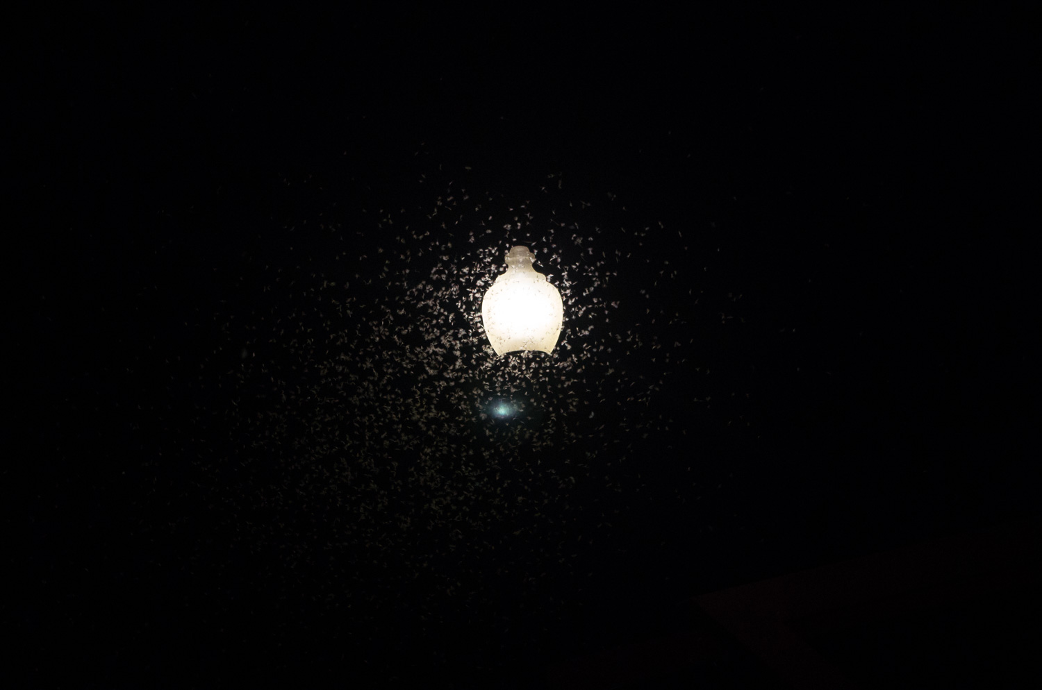
We arrived in our destination for the day prior to the onset of night fall Rock Springs, Wyoming. Prior to sleeping for the night, we rode down to Green River with our friend Kimberlee (who so kindly offered us a place to stay). Once we arrived at a park that is located on the river in town, we saw thousands upon thousands of moths flocking to the lights in the park. so many that you-couldn’t avoid stepping on them!
Day Three
Day three started off with us planning over breakfast. As we finished eating we agreed that we would like to see the wild horse loop and a few other things in the Rock Springs area prior to starting our drive to Jackson.
The Wild Horse Loop
If you ever wanted to see the wild horses of North America, ones that are descendants of the horses that the Spanish let go when they came to the continient in the 1500’s, then the wild horse loop outside of Rock Springs, Wyoming is the place to do it. Things to know before you set out on this two-hour side trip: The road is gravel and people like to leave spent firearms casings on it. Other things that are handy to know are a) if you have roadside assistance, or b) if you can change a tire at over 9,000 feet. It so happens that I am able to change a tire at over 9,000 feet with the sun beating down on me (with a little help of course). That being said you must keep in mind that when traveling with another photographer you might become the subject of a photograph yourself. Shelley of course took the following photograph of me changing the tire.
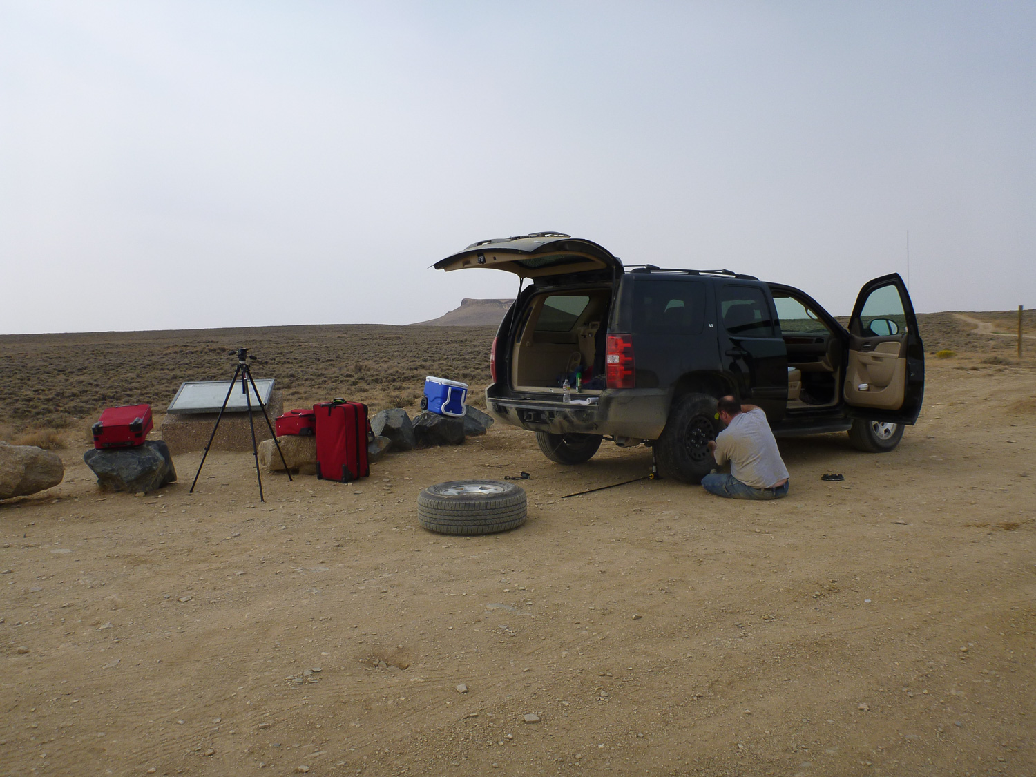
Besides the fact that we had to locate and change the tire on a vehicle that we did not know, we all enjoyed driving the loop and seeing the wild horses. Below is my favorite photograph that I took while doing the loop.

On to Jackson
Along the drive from Rock Springs to Jackson, the landscape changed from that of the high desert to valleys and mountains. Once we started getting closer to Jackson the sun was getting lower in the sky. At one point we saw that the setting sun was breaking through the clouds over the Snake River. This is one of those times that our journey provided a great visual, but there was no time to get the photograph. By the time I found a place to pull off of the road and set up for the shot, it was gone. That is why I call the following photograph the Missed Setting Sun Over the Snake River.

After missing the setting sun over the Snake River we proceeded on to Jackson for the night.


